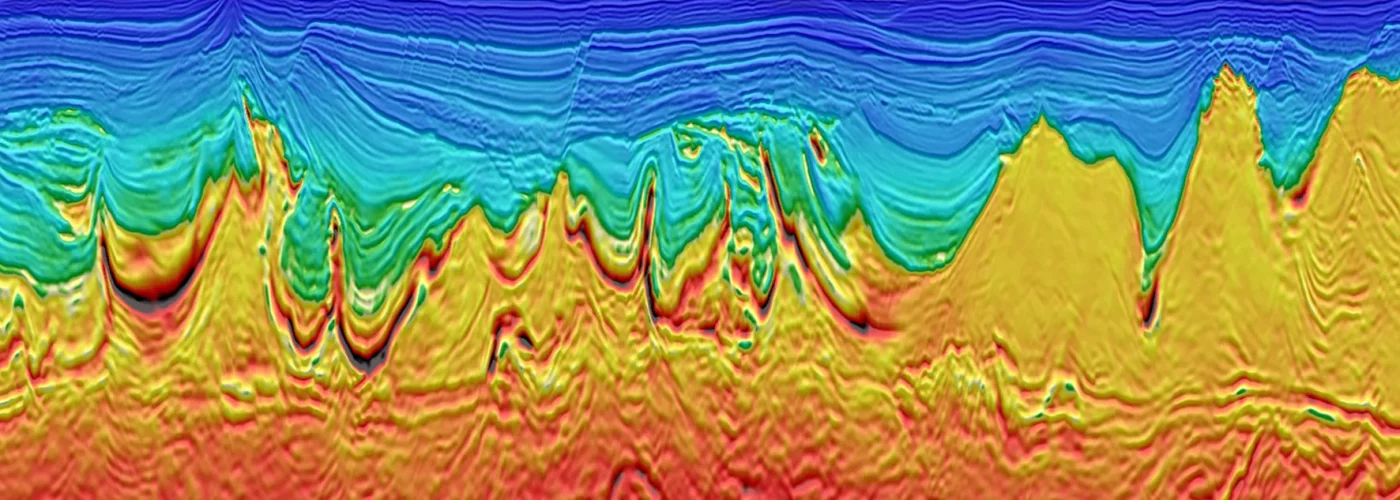
Infrastructure projects often run into unexpected delays and extra costs due to hidden pipes, cables, or objects underground. Subsurface imaging technology gives professionals a clear view beneath the surface, making planning and changing infrastructure without guesswork easier. This tool uses methods like ground penetrating radar to scan and map what lies unseen, helping teams avoid accidents and expensive mistakes.
Anyone involved with construction, utilities, or land development can use subsurface imaging technology to make fast and safer decisions. By viewing underground layouts before digging, teams can update project plans or shift project designs as needed. These tools make it simple to locate anything hidden out of sight, all before breaking ground, which streamlines projects from the start.
Many modern systems, such as those found in advanced subsurface imaging technology, support different project needs, from detecting utilities to mapping underground conditions for building or remodeling. Using the latest innovations not only protects workers and infrastructure but also keeps projects moving smoothly and on time.
Implementing Subsurface Imaging Technology in Infrastructure Projects
Subsurface imaging technology makes it possible to map underground utilities, soil features, and other hidden details before building starts. Using the right approach can prevent costly mistakes and delays by giving teams better information.
Assessment of Existing Project Infrastructure
The first step is to understand what infrastructure is already present beneath the ground. This involves looking at old maps, records, and visual inspections of the area. Teams review drawings and documents to find out where pipes, wires, or previous structures might be buried.
After gathering paper records, a physical walk-through helps confirm if there are any changes not updated in the documents. Written notes and digital photos are taken during the inspection. This early work helps point out areas where risk is higher, like near busy roads or where past repairs have been made.
Key goals during assessment include:
- Locating known utilities and structures
- Logging any signs of surface damage or previous digging
- Marking sections that might be hard to scan or reach
A thorough assessment helps teams avoid surprises during scanning and digging.
Selection of Appropriate Subsurface Imaging Methods
Different technologies work better for certain conditions. Ground-penetrating radar (GPR) is often used to find non-metallic pipes, voids, and cracks. To detect metal pipes or wires, teams might use electromagnetic locators. When scanning deeper, seismic imaging or 3D reality capture is useful for mapping layers underground.
Below is a simple reference guide:
| Technology | Best Use Cases |
| Ground-Penetrating Radar | Concrete, soil, and non-metal pipes |
| Electromagnetic Locators | Metal pipes, cables |
| Seismic Imaging | Deeper surveys, layered ground |
| 3D Reality Capture | High detail, complex locations |
Factors like soil type, required depth, and potential obstacles affect which method is selected. Combining several techniques often gives the clearest results.
Integration with Project Planning and Design
After collecting imaging data, project planners add the information to their maps and design files. Building Information Modeling (BIM) systems are commonly used to organize and display the findings. This allows engineers, architects, and site managers to update their plans to avoid underground risks.
Visualizing the underground features makes the design process smoother by clearly showing what areas to avoid or protect. Design teams then adjust routes, foundation spots, or excavation methods based on the real-world data. Teams hold meetings and review sessions so everyone understands the changes.
Effective integration reduces the chances of digging into hidden hazards and helps schedules stay on track.
Benefits and Challenges of Upgrading Infrastructure With Subsurface Imaging
Adopting subsurface imaging technology helps improve safety, planning, and cost control for projects that involve underground assets. Teams face both clear advantages and real-world obstacles when using these advanced mapping methods.
Improved Risk Management and Safety
Subsurface imaging helps identify hidden pipes, cables, and voids before digging starts. By knowing where these features are, crews can avoid unexpected strikes, which reduces the chance of injuries and service outages.
It also limits the need for manual checks, which lowers exposure to hazards such as unstable ground or contaminated soil. Alerting workers to unknown hazards allows safer planning and better response to emergencies.
Routine updates with modern imaging give decision-makers current data, supporting quick adjustments if conditions or site layouts change.
Cost Efficiency and Resource Optimization
Accurate underground maps cut down on costly mistakes, such as accidentally breaking utility lines during excavation. They also allow for better use of equipment because crews know exactly where to dig and how deep to go.
Fewer project delays and less rework help save money throughout a project’s lifecycle. Real-time access to digital maps gives engineers and managers a clear plan, reducing scheduling gaps and improving time use.
Maintenance teams can act faster when issues appear, leading to fewer disruptions and less waste of resources.
Overcoming Technical Limitations
Subsurface imaging has limits. Results can change depending on soil type, depth, moisture, and the materials present underground. In some environments, signals weaken and reduce the quality of the images produced.
Operators need special training to read the maps and understand device settings. Not every location supports the same level of detail, which can sometimes miss specific features or show data that is hard to interpret.
Updating old infrastructure records and merging them with new data can be challenging, especially for sites with incomplete historical information.
Conclusion
Subsurface imaging technology gives projects a clearer view of what lies underground. Teams can use this technology to locate pipes, cables, and other structures before building or digging.
It leads to better planning, fewer surprises, and can save both time and money. Problems such as accidental damage to underground utilities happen less often.
Subsurface imaging methods, like ground-penetrating radar, support safer and more efficient work. As technology advances, project outcomes can keep improving with these tools.


